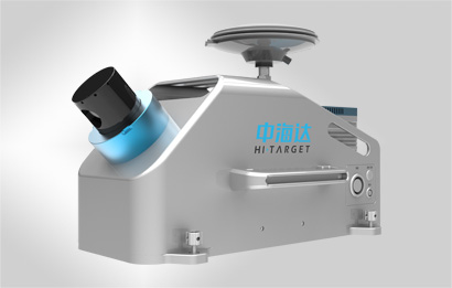
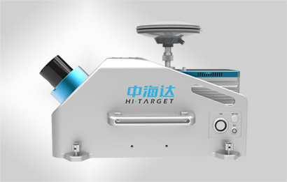
توضیحات
راه حل های بسیار یکپارچه
- کالیبره شده کامل در کارخانه، بدون نیاز به کالیبراسیون مجدد
- ابرنقاط بسیار منطبق بر تصاویر پانوراما
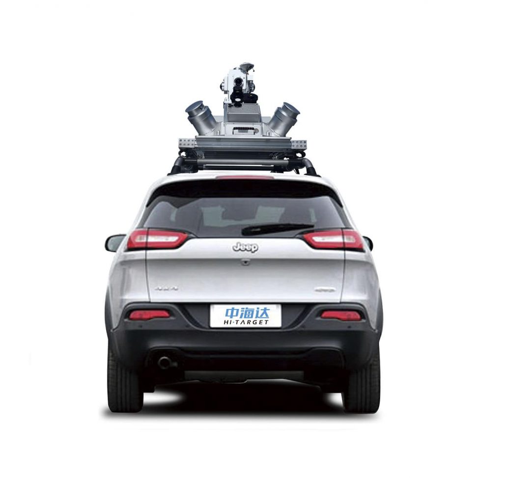
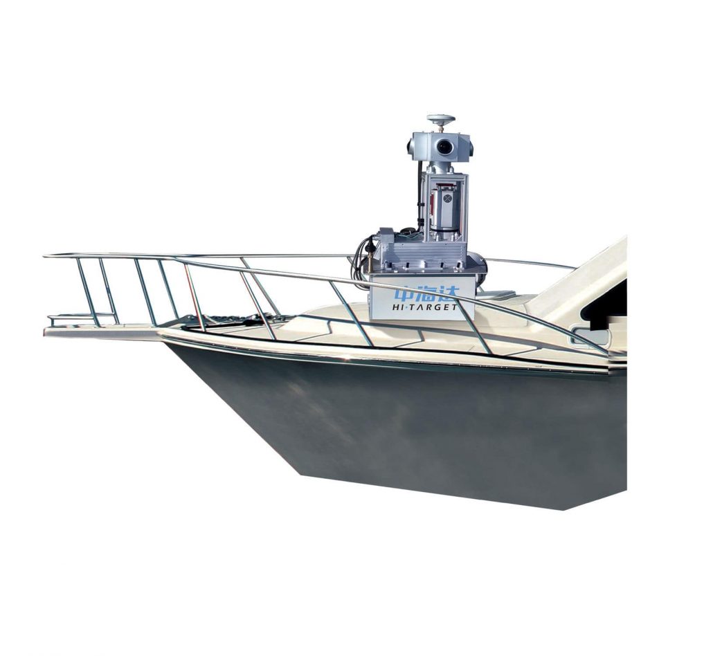
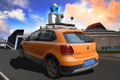
- نصب آسان بر روی هر نوع وسیله نقلیه
- تراکم و دقت بسیار بالای ابر نقاط
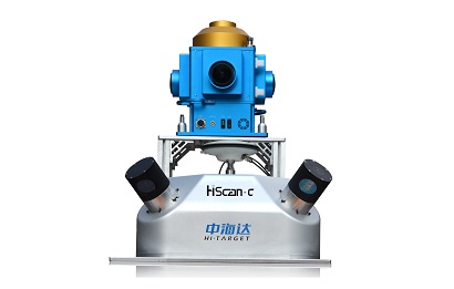
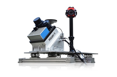
ویژگی های کلیدی MMS (Mobile Mapping System)
- راه حل کاملا یکپارچه
- کالیبره شده کامل در کارخانه، بدون نیاز به کالیبراسیون مجدد
- تراکم و دقت بسیار بالای ابر نقاط
- ابرنقاط کاملا منطبق بر تصاویر پانوراما
- نصب آسان بر روی هر نوع وسیله نقلیه
- جعبه نگهداری برای حمل و نقل آسان
- طراحی و توسعه لیزر اسکنر با دانش داخلی
کاربردها
سیستم نقشه برداری متحرک HiScan به طور گسترده ای در نقشه های اینترنتی نمایش خیابان، نقشه برداری و تهیه نقشه به صورت نواری، شهر دیجیتال سه بعدی و مدیریت شهری دیجیتال، امنیت عمومی دیجیتال، حمل و نقل هوشمند، کانال های دیجیتال، نقشه برداری دیجیتال و زمینه های کاربردی نقشه برداری همانتد معادن، و صخره های دریایی و غیره مورد استفاده بوده است.
کاربردهای مدل سه بعدی
HiScan Mobile Mapping System در جمع آوری داده شامل داده ابر نقاط سه بعدی، می تواند به کار رود. مربوط به تصاویر بافت با وضوح بالا و تصاویر پانورامیک در هر دو طرف جاده می تواند به کار رود. سپس مدل های سه بعدی می تواند با تکنولوژی ترکیب داده تولید شود.
کاربرد مدیریت شهری دیجیتال
HiScan Mobile Mapping System می تواند مختصات سه بعدی اطلاعات شی هدف را در دو طرف جاده به سرعت بدست آورد. نرم افزارش می تواند ویژگی های کاربردی را به سرعت شامل مدیریت اموال شهری، تبلیغات محیطی، درختان باغ و علائم راهنمایی و رانندگی. از این سیستم در مدیریت شهری دیجیتال، امنیت عمومی، چشم انداز دیجیتال و ترافیک دیجیتال می تواند استفاده شود.
کاربرد ترافیک دیجیتال
HiScan Mobile Mapping System می تواند مجموعه داده های زیرساخت حمل و نقل را تهیه کند، تولید، کاربردهای یکپارچه پلت فرم مدیریت برای ساخت کل فرآیند خدمات حمل و نقل دیجیتال راه حل های یکپارچه، که می تواند به طور گسترده ای در مدیریت اطلاعات صنعت ترافیک و طراحی جاده استفاده شود، به حرکت نوسازی و توسعه برچیده شود، انجام بازرسی و پذیرش پل ها و جاده ها، دریای دیجیتال، کانال تنظیم تجسم، و غیره باشد. فرم داده های Hi-Scan می تواند در مدیریت، نوسازی، تعمیر و نگهداری حمل و نقل، تصمیم گیری های اضطراری و خدمات عمومی به کار رود.
آبراه دیجیتال یا منطقه ساحلی
HiScan Mobile Mapping System می تواند تصویر فیزیکی و اکتساب داده های سه بعدی، شامل کانال، خاکریزها، ناحیه ساحلی را واقعی کند. آن همچنین می تواند کانال، داده های جغرافیایی مبنا در ناحیه ساحلی و مدیریت انبار ساختمان را اقناع کند، و داده های پشتیبانی برای ساخت دیجیتال آبراه یا ناحیه ساحلی.
نرم افزار پس پردازش
Hi-Target نه تنها از قدرت قوی فنی برای تحقیق و توسعه سخت افزار استفاده کرده است بلکه همچنین سیستم نرم افزار شامل نرم افزار پردازش ابر نقاط، نرم افزار نقشه برداری دیجیتال، نرم افزار مدل سازی سه بعدی، نرم افزار تصویربرداری سه بعدی، نرم افزار پایه و اساس پایگاه داده و غیره.
مدل سازی ابر نقطه HD
- پشتیبانی از حالت های مختلف تفسیر ابر نقاط و حالت های نمایش داده ها
- امکان ویرایش ابر نقاط، قطع پردازش، مشاهده قسمت دلخواه و چندین قسمت و مدیریت بخش ها
- پشتیبانی از فیت کردن اتوماتیک سطح، خط، استوانه، زانو استوانه و غیره.
- پشتیبانی از ورودی ها و خروجی های اطلاعاتی نرم افزارهای مدل سازی دیگر
ابر نقاط وکتوری HD برای AutoCAD/ArcGIS
پشتیبانی از نمادهای دیجیتال نقشه کشی، نقطه، خط، استخراج عناصر ویژگی سطح
فراهم کردن مجموعه نمادهای نقشه و نمادهای نقشه تعریف شده توسط کاربر
پشتیبانی از تفسیر ابر نقاط، ویرایش، فیلتر خودکار و تنظیم تراکم
نمایش خیابان ابر نقاط HD
پشتیبانی از ویرایش سریع محل روابط نزدیک، ایجاد یک محل پانورامیک از روابط توپولوژیک
پشتیبانی اضافه کردن و ویرایش پیام جهت پرش پانوراما (علائم جاده، و غیره)
پشتیبانی از استخراج اتوماتیک قطعه ها، و پشتیبانی از تشخیص اتوماتیک قطعه های سه بعدی داخلی
علامت گذاری نقاط نمایش داده شده و نقاط مورد علاقه در پانوراما، و نمایش کاربرد واقعی اطلاعات علائم
فراهم کردن انتشار برنامه واقعی با یک کلیک
HD MapCloud RealVision
گشت و گذار ناوبری راحت و روان و پریدن زنده، بزرگ نمایی، کوچک نمایی و حرکت
پشتیبانی و تطبیق نقشه سناریو دو بعدی و نقشه کوچک صحنه پرش مشترک
پشتیبانی از انتخاب قطعات توسط موس، رسیدن به پریدن بر منبای قطعه ها؛ پشتیبانی از اندازه گیری بر روی پانورامیک
پشتیبانی از بارگذاری لحظه ای متن، تصاویر، فایل صوتی، ویدئو و سایر اطلاعات برچسب گذاری
پشتیبانی از پایانه تصویربرداری سه بعدی و گشت و گذار تلفن همراه Android/iOS
HD MapCloud 3DVirtual
پشتیبانی از بارگذاری مدل سه بعدی یکپارچه، پشتیبانی رو میزی با دو نوع مرورگر مجازی سه بعدی اینترنت حالت B/S
تجربه مرور گشتن مجازی سه بعدی همه جانبه و راحت را فراهم می کند
پشتیبانی از اول شخص و سوم شخص در حالت مرورگر پروازی
پشتیبانی از افکت های منظره ای (طلوع آفتاب، باران، برف، مه و غیره) کلید آنالوگ صوتی، تصویری و سایر اطلاعات برچسب گذاری
پشتیبانی از پایانه تصویربرداری سه بعدی و گشت و گذار تلفن همراه Android/iOS
مشخصات فنی
| مدل | HiScan-C SU1 | HiScan-C SU2 | |
| تعداد اسکنر ها | تک لیزری | دو لیزری | |
| برد اندازه گیری | تا 650 متر | تا 650 متر | |
| نرخ اندازه گیری | تا 500000 نقطه در ثانیه | تا 1000000 نقطه در ثانیه | |
| اسکن با دقت زاویه ای | 0.001° | 0.001° | |
| زاویه اندازه گیری | 360° | 360° | |
| وضوح تصویر پانورامیک | iView | 75 میلیون پیکسل | 75 میلیون پیکسل |
| Ladybug5 | 30 میلیون پیکسل | 30 میلیون پیکسل | |
| دقت | 5cm در 100m | 5cm در 100m | |
| سرعت اسکن | تا 200Hz | تا 2X200Hz | |
| وزن | 15kg | 15kg | |
hitarget


نقد و بررسیها
هنوز بررسیای ثبت نشده است.